Search conditions
Category
Area
Central Hokkaido
- Sapporo/Jozankei
- Sapporo Hitsujigaoka Observation Hill, Mount Moiwa, Hoheikyo Dam, etc.
- Area around Sapporo
- Lake Shikotsu, Northern Horse Park, Lake Katsurazawa, etc.
- Area around Otaru, Niseko
- Otaru Canal, Shakotan Peninsula, Mount Yotei, outdoor experiences, etc.
- Area around Toya, Noboribetsu, and Hidaka
- Lake Toya, Mount Usu, Jigokudani, Cape Erimo, etc.
Southern Hokkaido
- Hakodate, area around Hakodate
- Mount Hakodate, Hakodate morning market, Goryokaku Park, Onuma Quasi-National Park
- Matsumae, Esashi, Okushiri
- Matsumae Castle, Former Nakamura Family Merchant House, Okushiri Island
Northern Hokkaido
- Asahikawa, Sounkyo, Tenninkyo
- Asahiyama Zoo, Kurodake, Asahidake, Tohma Limestone Cave, etc.
- Area around Furano, Biei
- Lavender Farm, Blue Pond, Unkai Terrace, etc.
- Wakkanai, Rishiri, Rebun, Rumoi
- Cape Soya, Path of White Shells, Rebun Island, Rishiri Island, Kunimare Sake Brewery, etc.
Eastern Hokkaido
- Shiretoko, Abashiri, Monbetsu
- Shiretoko Five Lakes, whale watching, drift ice, Abashiri Prison Museum, Road to the Sky, etc.
- Tokachi, Obihiro
- Gardens, Mikuni Pass, Lake Shikaribetsu, Lake Onneto, etc.
- Kushiro, Lake Akan, Lake Mashu, Nemuro
- Kushiroshitsugen National Park, Lake Akan, Lake Mashu, Lake Kussharo, Cape Nosappu, etc.
Distance
検索結果
We found 165 results
- Sort by
- Popularity
- Last Updated Date
- The Closest Location
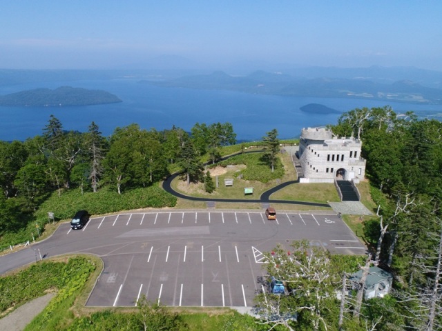
- Kijihiki Highlands
- For far-reaching views of Mt. Hakodate and the surrounding landscape of lakes and forest-swarmed h…
-
- Hakodate, area around Hakodate
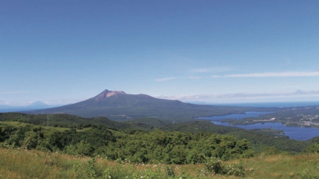
- detail_12967.html
- Onibi No Michi
- The promenade leading from the entrance of Noboribetsu Onsen's famous “Noboribetsu Hell …
-
- Area around Toya, Noboribetsu, and Hidaka
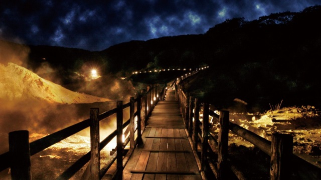
- detail_11429.html
- Momoiwa Observation Deck
- Rebun Island is the perfect spot for adventurers looking for a rugged mountain trail and stunning …
-
- Wakkanai, Rishiri, Rebun, Rumoi
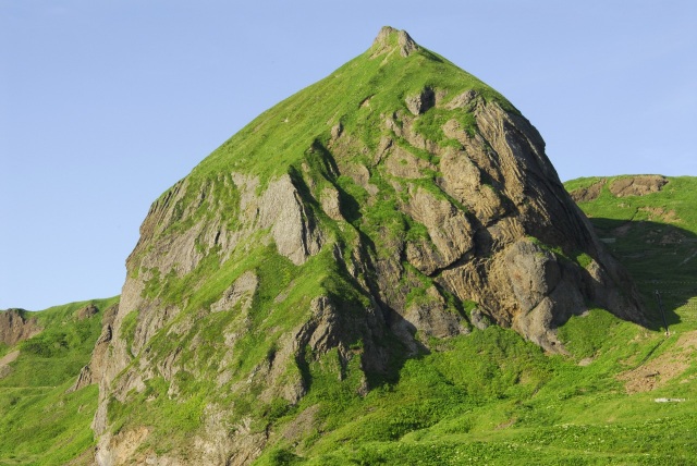
- detail_10386.html
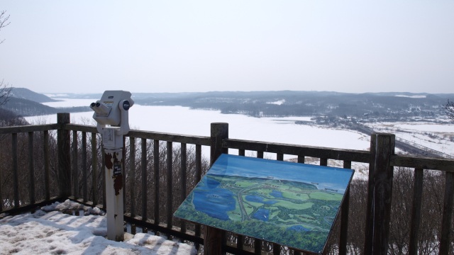
- Ura-Mashu Observatory
- The observatory, located on the border between Kiyosato Town and Nakashibetsu Town, is called the …
-
- Kushiro, Lake Akan, Lake Mashu, Nemuro
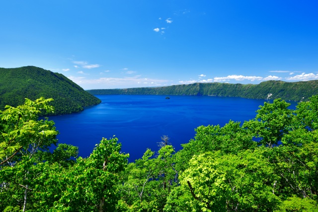
- detail_10415.html
- Tsubetsu Pass Observation Facility
- Located between Tsubetsu Town and Teshikaga Town on the Kussharo-Tsubetsu Line, Tsubetsu Pass stan…
-
- Shiretoko, Abashiri, Monbetsu
- detail_12242.html
- Former Hanadake Banya
- From 1868 to 1950, the coasts along the Sea of Japan made herring fishers wealthy and prosperous. …
-
- Wakkanai, Rishiri, Rebun, Rumoi

- detail_10529.html
- Kamikongozan Observatory
- At 314 meters above sea level, the Kamikongozan Observatory overlooks the city of Ashibetsu and is…
-
- Area around Sapporo

- detail_12250.html
- Aikoku Station
- Aikoku Station, which became a huge boom along with Kōfuku Station in the 1970s with the catchphra…
-
- Tokachi, Obihiro
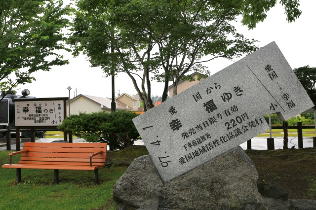
- detail_10130.html
- Sarubo Observatory
- Sarubo Observatory offers views of five lakes, including Tōro Lake, the largest in Kushiro Shitsug…
-
- Kushiro, Lake Akan, Lake Mashu, Nemuro
- detail_10479.html
- Nabetsuru Rock
- The unique shape of the rock, which resembles the vine of a pot, is the origin of its name. Nabets…
-
- Matsumae, Esashi, Okushiri
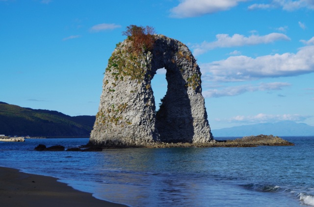
- detail_10316.html
- Senhoshi Misaki Park
- This is a nature park at the southernmost tip of Rishiri Island, and it is a viewing spot from whi…
-
- Wakkanai, Rishiri, Rebun, Rumoi

- detail_10391.html
- Cape Peshi
- Cape Peshi is a rocky cape with an elevation of 93 meters, located near the ferry terminal. It is …
-
- Wakkanai, Rishiri, Rebun, Rumoi

- detail_10395.html
- Cape Erimo Wind Museum
- Cape Erimo is one of Japan's most prominent strong wind areas, experiencing winds of over 10 m…
-
- Area around Toya, Noboribetsu, and Hidaka

- detail_10440.html
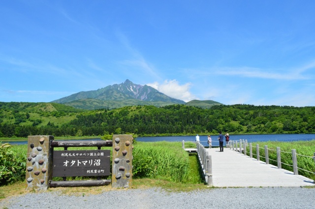
- Otatomari Swamp
- The waters of Otatomari Swamp, nestled by the coast of the northern Rishiri island, are vibrantly …
-
- Wakkanai, Rishiri, Rebun, Rumoi
- detail_10396.html
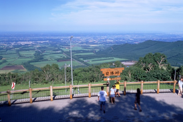
- Nissho Pass
- Nissho Pass, at an elevation of 1,106 meters, is the watershed between Hidaka and Tokachi. Before …
-
- Tokachi, Obihiro
- detail_13073.html
- Shiretoko World Heritage Rusa Field House
- At the "Shiretoko World Heritage Rusa Field House," mountaineers and sea kayakers (navig…
-
- Shiretoko, Abashiri, Monbetsu

- detail_10505.html
- Cape Puyuni Observatory
- Cape Puyuni is located on the northern coast of the Shiretoko Peninsula and its name means "p…
-
- Shiretoko, Abashiri, Monbetsu

- detail_12223.html
- Kashni Waterfall
- Kashni Waterfall, whose name means "place with a temporary hut" or "place with a hu…
-
- Shiretoko, Abashiri, Monbetsu

- detail_12224.html
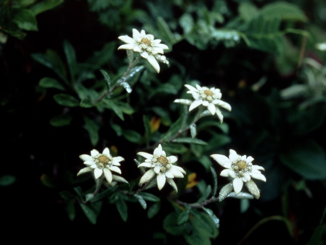
- Colony of Rebun Usuyukiso
- The Rebun Usuyukiso, with its pale white leaves resembling lightly fallen snow, is a perennial pla…
-
- Wakkanai, Rishiri, Rebun, Rumoi
- detail_10537.html
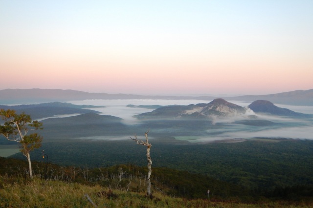
- Lake Mashu Third Observatory
- Located about 4 km north of the First Observatory, the "Lake Mashu Third Observatory" is…
-
- Kushiro, Lake Akan, Lake Mashu, Nemuro
- detail_10483.html