Search conditions
Category
Area
Central Hokkaido
- Sapporo/Jozankei
- Sapporo Hitsujigaoka Observation Hill, Mount Moiwa, Hoheikyo Dam, etc.
- Area around Sapporo
- Lake Shikotsu, Northern Horse Park, Lake Katsurazawa, etc.
- Area around Otaru, Niseko
- Otaru Canal, Shakotan Peninsula, Mount Yotei, outdoor experiences, etc.
- Area around Toya, Noboribetsu, and Hidaka
- Lake Toya, Mount Usu, Jigokudani, Cape Erimo, etc.
Southern Hokkaido
- Hakodate, area around Hakodate
- Mount Hakodate, Hakodate morning market, Goryokaku Park, Onuma Quasi-National Park
- Matsumae, Esashi, Okushiri
- Matsumae Castle, Former Nakamura Family Merchant House, Okushiri Island
Northern Hokkaido
- Asahikawa, Sounkyo, Tenninkyo
- Asahiyama Zoo, Kurodake, Asahidake, Tohma Limestone Cave, etc.
- Area around Furano, Biei
- Lavender Farm, Blue Pond, Unkai Terrace, etc.
- Wakkanai, Rishiri, Rebun, Rumoi
- Cape Soya, Path of White Shells, Rebun Island, Rishiri Island, Kunimare Sake Brewery, etc.
Eastern Hokkaido
- Shiretoko, Abashiri, Monbetsu
- Shiretoko Five Lakes, whale watching, drift ice, Abashiri Prison Museum, Road to the Sky, etc.
- Tokachi, Obihiro
- Gardens, Mikuni Pass, Lake Shikaribetsu, Lake Onneto, etc.
- Kushiro, Lake Akan, Lake Mashu, Nemuro
- Kushiroshitsugen National Park, Lake Akan, Lake Mashu, Lake Kussharo, Cape Nosappu, etc.
Distance
検索結果
We found 75 results
- Sort by
- Popularity
- Last Updated Date
- The Closest Location
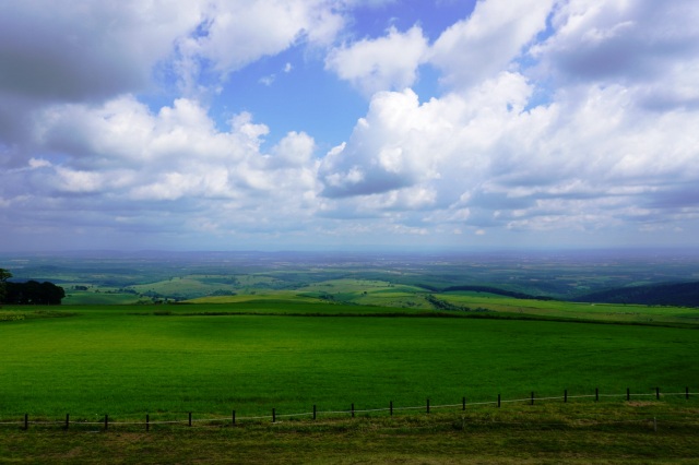
- Mikuni Pass Observation Deck
- Mikuni Pass, at 1,139 m, is the highest among all the national highways in Hokkaido. A vast sea of…
-
- Tokachi, Obihiro
- detail_10513.html
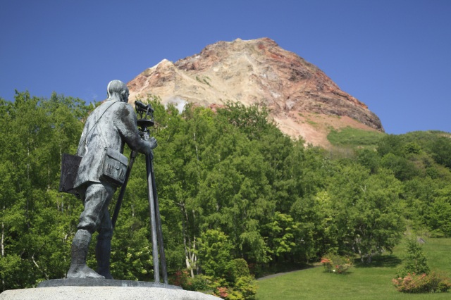
- Mount Showa-Shinzan
- Mount Showa-Shinzan was born as a result of volcanic activity that began in 1943. A flat, level wh…
-
- Area around Toya, Noboribetsu, and Hidaka
- detail_10049.html
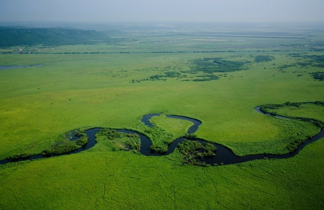
- Kushiro Shitsugen National Park
- Kushiro Marsh is a national park consisting of Japan's largest marshland, the Kushiro River an…
-
- Kushiro, Lake Akan, Lake Mashu, Nemuro
- detail_10244.html
- Bihoro Pass
- The Bihoro Pass, located in the middle of National Route 243, connects Bihoro and Teshikaga in Eas…
-
- Shiretoko, Abashiri, Monbetsu
- detail_10398.html
- Marukoma Hot Spring
- Marukoma Onsen is a long-established, secluded lodge on the northern shore of Lake Shikotsu. The n…
-
- Area around Sapporo
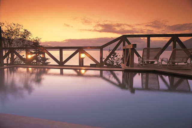
- detail_10627.html
- Mt. Usu
- Toya-Usu Geopark holds the honor of being Japan’s first UNESCO Global Geopark. Come to explo…
-
- Area around Toya, Noboribetsu, and Hidaka
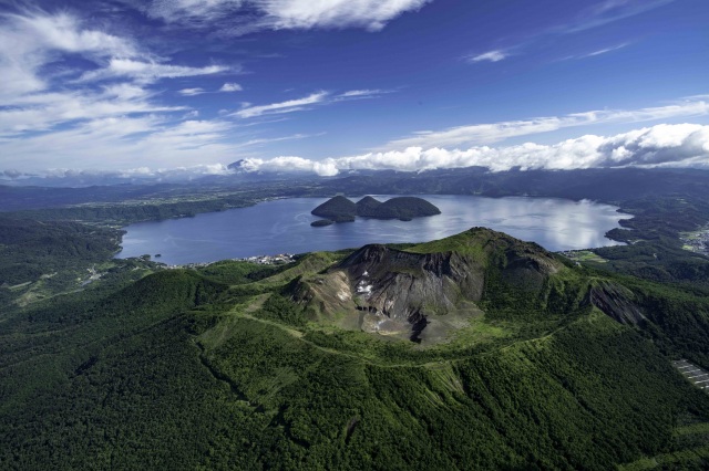
- detail_10177.html
- Sugatami-no-Ike
- This scenic hiking course from the Asahidake Ropeway Sugatami Station takes less than 2 hours to c…
-
- Asahikawa, Sounkyo, Tenninkyo
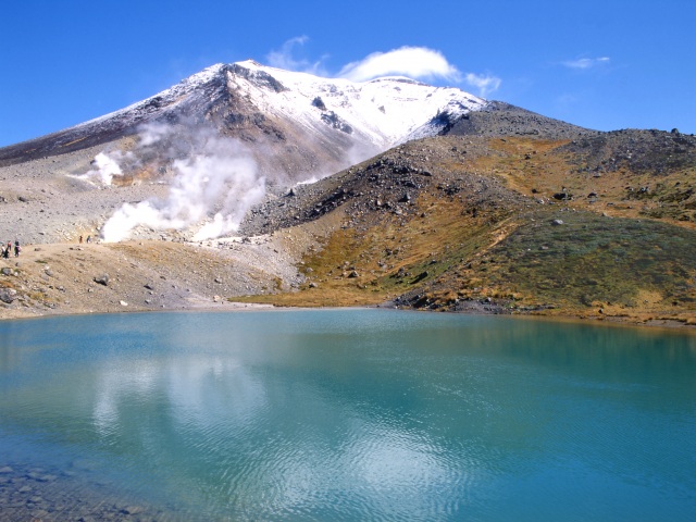
- detail_11432.html
- Lake Onneto
- Located in the Akan-Mashu National Park, Lake Onneto is a breathtaking sight that appears to chang…
-
- Tokachi, Obihiro
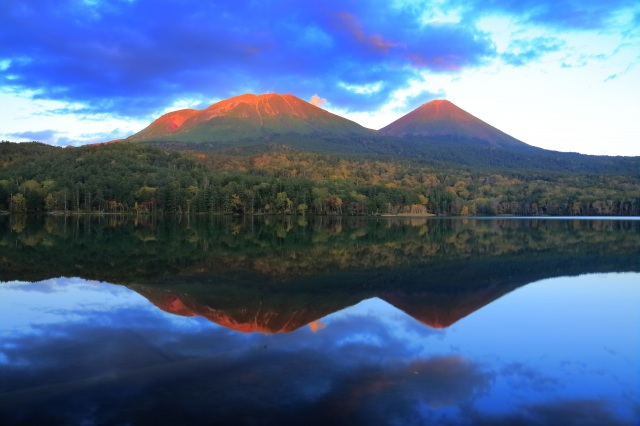
- detail_10469.html
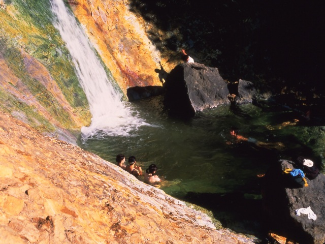
- Kamuiwakka Hot Falls
- Kamuiwakka Hot Spring Falls is a secluded outdoor hot spring river that sits at the center of the …
-
- Shiretoko, Abashiri, Monbetsu
- detail_10412.html
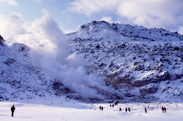
- Mt. Io
- Mt. Io is an active volcano with an altitude of 512 m. White smoke containing sulfur rises from th…
-
- Kushiro, Lake Akan, Lake Mashu, Nemuro
- detail_10481.html
- Mt. Hakodate
- Mt. Hakodate offers a panoramic view of Hakodate's cityscape. The spectacular view created by …
-
- Hakodate, area around Hakodate
- detail_10095.html
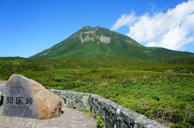
- Shiretoko Pass
- The Shiretoko Odan Road crosses between east and west of Shiretoko Peninsula, which is is located …
-
- Shiretoko, Abashiri, Monbetsu
- detail_10401.html
- Naitai Kogen Farm, Naitai Terrace
- Naitai Kogen Farm in Kamishihoro, Tokachi area, is Japan’s largest public farm with an area …
-
- Tokachi, Obihiro
- detail_10448.html
- Hosooka Observatory
- Kushiro Marsh offers a panoramic view of the magnificent scale of the endless expanse of Kushiro M…
-
- Kushiro, Lake Akan, Lake Mashu, Nemuro
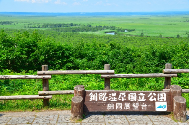
- detail_10181.html
- World Natural Heritage Site, Shiretoko
- Located on a peninsula that stretches out into the Sea of Okhotsk, Shiretoko National Park takes i…
-
- Shiretoko, Abashiri, Monbetsu
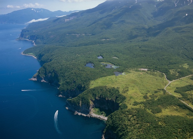
- detail_10048.html
- Shiretoko Goko Lakes
- The Shiretoko Goko Lakes, one of the eight scenic spots in Shiretoko, are fantastic lakes surround…
-
- Shiretoko, Abashiri, Monbetsu

- detail_10404.html
- Kushiro City Tancho Crane Nature Park
- The red-crowned crane, designated as a Special Natural Monument of Japan, is not only admired for …
-
- Kushiro, Lake Akan, Lake Mashu, Nemuro
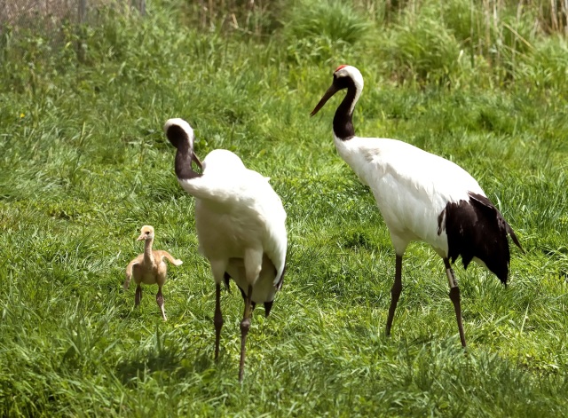
- detail_10014.html
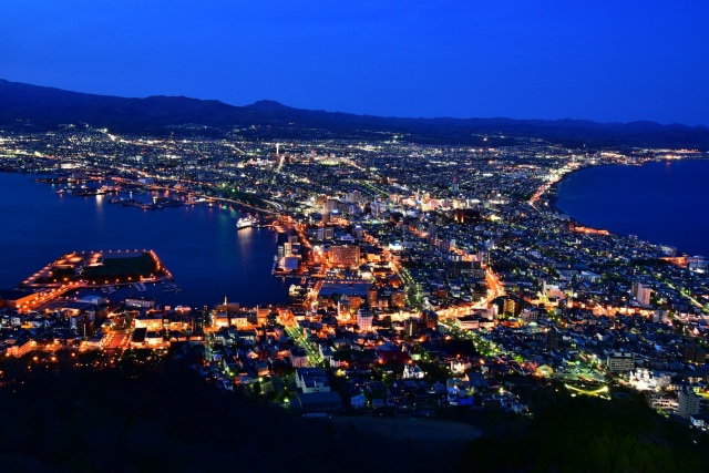
- Mt. Okura Observatory
- One of the most famous night views in the country, Okurayama Viewing Point, an observation deck in…
-
- Sapporo/Jozankei
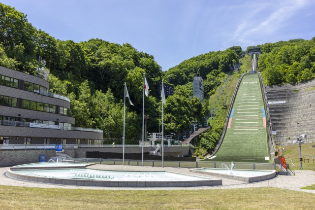
- detail_10524.html
- Notsuke Peninsula
- Located between the Shiretoko Peninsula and the Nemuro Peninsula, the Notsuke Peninsula stretches …
-
- Kushiro, Lake Akan, Lake Mashu, Nemuro
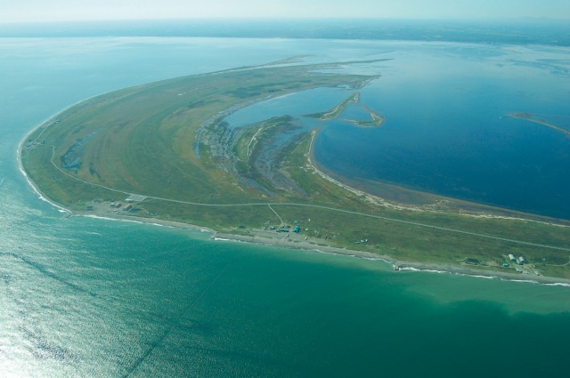
- detail_10494.html
- Highland Furano
- This lodging facility is located in a lavender forest on the outskirts of Furano. After enjoying a…
-
- Area around Furano, Biei
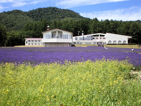
- detail_10153.html